
EDITOR’S NOTE:
Most of this information is on the internet, but is very difficult to find, especially when using a cell phone so we are repeating some information for the benefit of the people that want to find more information.
During our research on the effect of the Hobart Data Center on the environment, we found the Hobart Marsh Plan document worth looking into. This 21 page document was published in 2016, further emphasizes the importance of the Hobart Marsh Ecological importance. The area location is bounded by Interstate 65 to the west; South LaSalle Street to the east; 49th Avenue to the north; and 57th Street to the south. The proposed Hobart Data Center is at 61st Ave., just 4 blocks south.
The Deep River / Portage Burns watershed, identified as the hydrologic unit code (HUC) watershed 0404000105, covers a drainage area of approximately 180 square miles in Northwest Indiana, of which 104 square miles are located in Lake County, and 20 square miles are located in Porter County. There are approximately 125 miles of impaired streams within the watershed boundary.
In 2011, the Northwestern Indiana Regional Planning Commission (NIRPC) identified the Deep River-Portage Burns Waterway Watershed as a priority in the Northwest Indiana Watershed Management Framework. The decision to include the watershed as a priority was based on persisting water quality issues, but more importantly, because stakeholders continued to express interest in reinvigorating these past efforts. With substantial changes in land use being evident, there was enough support to update the previous watershed plans into a single comprehensive plan.
This project was funded in part by a grant from the U.S. Department of Commerce, National Oceanic and Atmospheric Administration, and is being administered by the Indiana Department of Natural Resources, Lake Michigan Coastal Program. Compliance with all applicable federal, state, and local laws, rules, and regulations is required.
The City of Hobart’s Robinson Lake Park, a large single family subdivision, several properties owned and managed by the Shirley Heinze Land Trust and Save the Dunes, the National Park Service’s Indiana Dunes National Lakeshore Prairie Grove Property, the Trust Public Land, the Lake County Parks Departments Oak Savannah Trail, and several additional IDNR properties including the McCloskey’s Burr Oak Savanna Nature Preserve are all located near the mitigation sites. Shirley Heinze Land Trust’s Hidden Prairie Ivory Wetland is located just across I-65 and nearby Cressmoor Prairie.
This mitigation project established eight to ten different types of wetland communities in this quadrant of the City of Hobart. Much of the mitigation was in the form of mesic prairie; seeding drilled and widely spaced trees and shrubs will be installed. Plugs installed in wetland areas. Within existing forested areas to remain, the understory cleared of non-native plants and native understory shrubs were installed.
Hobart Indiana Environmental References:
2025 EPA Urban Waters Federal Partnership Work Plan: Restoring Duck Creek Tributary, Hobart Marsh Properties Managed by the Indiana DNR, Division of Nature Preserves, and Hobart Marsh Conservation Area known as NIPSCO Row.
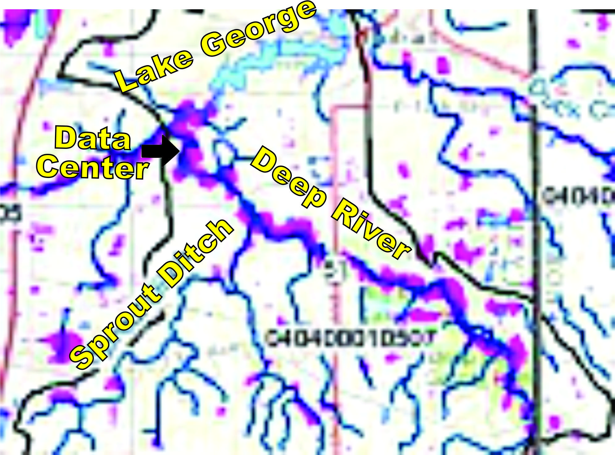
2017 – NIRPC – 377 Pages. Deep River Portage Burns Waterway Final: Deep River-Portage Burns Waterway watershed (Figure 1). It is the largest of six watersheds located within the Little Calumet-Galien sub-basin, draining approximately 180 square miles of north central Lake and Porter Counties to Lake Michigan. Some the major streams located within the watershed include Deep River, Main Beaver Dam Ditch, Turkey Creek, and the Little Calumet River’s West Branch. This watershed management plan is the result of numerous communities and organizations coming together to establish a framework to restore the nearly 125 miles of impaired stream within its boundaries.
2024 – Save the Dunes Conservation Action Plan – 50 pages Hobart Marsh And Deep River Conservation Area was designated a Priority 1 Conservation Area by Save the Dunes Executive Summary of 2023
2016 – IDEM – 373 Pages – Deep River Watershed Plan, Click here – The Deep River/Portage Burns watershed, identified as the hydrologic unit code (HUC) watershed 0404000105, covers a drainage area of approximately 180 square miles in northwestern Indiana, of which 104 square miles are located in Lake County, and 20 square miles are located in Porter County. There are approximately 125 miles of impaired streams within the watershed boundary.
2024 EPA – “Great Lakes Restoration Restoration Initiative” – (Grand Calumet River) 20 pages Click here
2020 DNR – Pages 47 and 78 – 81, Northwest Moraine Forest Legacy Areas : CFAA funds are provided to states through the State and Private Forestry (S&PF) organization of the USDA Forest Service. Currently, Indiana receives these funds annually to assist private forest landowners, promote healthy forest practices, assist communities with their urban forests and protect communities from wildfire. A large portion of the CFAA funding received by the Indiana Division of Forestry is passed to local organizations by way of grants that provide matching funds and additional implementation resources.
2018 the City of Hobart and the Northwestern Indiana Regional Planning Committee (NIRPC) engaged The Lakota Group The PLAN City of Hobart and the Northwestern Indiana Regional Planning Committee (NIRPC) have initiated a planning process to create a set of zoning standards to guide the use and design of sites within local conservation areas. The goal of this project is not to prohibit development, but to define the opportunities where development can take place in a manner that respects and enhances
conservation areas – both by reducing adverse impacts of adjacent land uses and by improving local access to wildlife where appropriate. The City of Hobart has engaged The Lakota Group along with Duncan Associates to complete this Conservation Zoning and Sub Area Plan.
2002 Chicago State University, (2002) 180 pages, Deep River – Turkey Creek Watershed Management Plan : In the late 1980’s, the City of Hobart, in partnership with a local private economic development organization, began a program to improve the community’s quality of life and retain and expand business within the City that resulted in a multi-phased lakefront development and downtown revitalization plan. Degrading water quality, recreational uses, and aesthetic issues began to pose a threat to the community’s investments in lakefront and downtown revitalization efforts as a growing sedimentation problem in Lake George was becoming obvious. Accumulating sediments were precluding the use of the lake as a recreational resource for boating, degrading habitat for biological communities, and reducing recreational fishing opportunities in the lake. In addition, overgrowing plant life began to cause an aesthetic nuisance to lake residents and recreational enthusiasts
2016 Hobart Marsh Plan (2016) Created by the IDEM, and Lake Michigan Coastal Program – The Deep River/Portage Burns watershed, identified as the hydrologic unit code (HUC) watershed 0404000105, covers a drainage area of approximately 180 square miles in northwestern Indiana, of which 104 square miles are located in Lake County, and 20 square miles are located in Porter County. There are approximately 125 miles of impaired streams within the watershed boundary.
In 2011, the Northwestern Indiana Regional Planning Commission (NIRPC) identified the Deep River-Portage Burns Waterway Watershed as a priority in the Northwest Indiana Watershed Management Framework. The decision to include the watershed as a priority was based on persisting water quality issues, but more importantly, because stakeholders continued to express interest in reinvigorating these past efforts. With substantial changes in land use being evident, there was enough support to update the previous watershed plans into a single comprehensive plan.
Chicago State University (2009) Stewardship in the Calumet Region – Again in partnership with SHLT, IDNR Nature Preserves, and possibly LCP and the Indiana Dunes National Lakeshore, Save the Dunes is part of a proposal for contract work and management at Hobart Marsh, a large complex in Hobart Prairie Grove (the majority of which is owned by the Indiana Dunes National Lakeshore). Hobart Prairie Grove is a very large complex of wetlands, and the goal is to convert old agricultural fields on the site into restored prairie. Should funding be secured, the project would begin in 2010. The site is in need of prescription fire and cattail control, among other restoration work. Another Great Lakes proposal which Save the Dunes is a part of is one that is an Indiana Department of Environmental Management proposal. This proposal involves restoration at all the dune and swale projects managed by SHLT, STD, IDNR Nature Preserves, TNC, and LCP.
(2025) UNIVERSITY OF MICHIGAN: Gerald Ford School of Public Policy:
What Happens When Data Centers Come To Town : Current technologies force a tradeoff between energy and water efficiency, limiting sustainable solutions. Data Centers Do Not Bring in High Paying Jobs; Data Center Tax Breaks Only Benefit Corporations; Reduces Tax Revenue for School Districts; Higher Energy Rates for Consumers; Higher Resource Consumption; And Much More.
The Indiana Natural Heritage Data Center (INHDC) represents a comprehensive attempt to determine the state’s most significant natural areas through an extensive statewide inventory. However, the inventory is a continuous process. Over the past 10 years, 57 element occurrences were documented in the watershed including 54 ETR species and 3 high quality natural communities. (Please note, to find this info click here and you’ll find the link at the bottom)
MORE ENVIRONMENTAL RELATED ARTICLES . . .

Data Center’s Low Frequency Noise Is a Hidden Danger Nobody Is Talking About
Do you know what Low Frequency Noise is? Well, if you don’t, you’re in good company, because neither does your City Council, or the Leaders approving the Data Centers being built next to where people live. Expansive parking lots and flat fields offer no protection against LFN dangers. The brain can process a train…

West Little Calumet River Wetland Restoration Project in Gary, Hammond and Hobart Indiana
The Wetlands Initiative (TWI) was awarded a $794,000 grant from the National Fish and Wildlife Foundation’s (NFWF) National Coastal Resilience Fund (NCRF) to complete this “Community-centered Final Design” phase. This project is being collaboratively facilitated by the Little Calumet River Conservation Collaborative. The West Branch of the Little Calumet River corridor covers…

EMF Concerns at Data Centers (And Mechanical Waves)
Data Centers pose greater net risks by creating “EMF Vibrations” that degrade the quiet and natural habitat wildlife relies on for food, reproduction, communication, navigation and survival. Furthermore, what most people are ignoring is the fact that there are High and Low Mechanical Waves and there are High and Low EMF Waves, each…

Indiana Dunes Adds “Centennial Challenge” in 2026
This adventure takes you throughout the park. You may complete the 10 Locations challenge in one or more visits. Show your photos to the interpretive naturalist to earn a sticker. If the Nature Center is closed upon your completion, email your photos and mailing address to SPContests@dnr.IN.gov, and your sticker will be mailed…

Alarming Health Implications from Virginia’s Data Center boom
Many Hobart Data Center proponents site the successes of Virginia’s Data Centers as an example of their “safe” uses. That was then, this is now. Many Alarming impacts have come out after Virginia’s Data Center boom started published by George Mason University, Fairfax, Virginia. A new groundbreaking study uncovers the alarming Health…

Documented Endangered Species at Hobart Indiana’s Data Center Location
Since the Indiana Natural Heritage Data Center Database does not guarantee the existence of Endangered Species in the Deep River Wetland area of Hobart Indiana, we have collected photographs from Hobart Residences that live there. We would like to thank these residents for their devotion to this project, but are also looking for…

EPA to Spend 200 Million Dollars to Clean Up Grand Calumet River
While long-term dredging in the Indiana Harbor Canal (Phase 2) began in 2021, new major cleanup projects for both the Indiana Harbor and the Grand Calumet River are set to begin in late 2026, following a 2026 EPA announcement of over $200 million for sediment remediation and restoration to remove pollutants. (More info…

Indiana Environmental Impact Studies
We found some very interesting Environmental links from the National Environmental Policy Act (NEPA) and hazardous material requirements. This Office is responsible for red flag investigations, Phase I & II environmental site assessments (ESA), remediation of contamination discovered during construction, noise barrier assessments, air quality reviews, and the preparation/ review of NEPA documents.…

Data Centers Have Been Known to Damage Wetlands
The Deep River wetlands around Hobart Indiana’s Deep River flows through Lake County Indiana towards Lake Michigan. Deep River wetlands refer not just to a single swamp or marsh, but to a network of wetlands, riparian corridors, floodplains, forested bottomlands, marshes, woodlands, savannas, lakes, rivers, ravines, bottomland forests and prairie habitats that are scattered…

Hobart In Lake County Indiana is Known for it’s Biodiversity and Wetland Ecosystems
Northwest Indiana—especially Lake County along the southern shore of watershed basin of Lake Michigan — contains one of the most ecologically diverse regions in the whole county. This diversity comes from the area’s unique glacial history, the mixing of dune, wetland, and prairie ecosystems, and the influence of Lake Michigan’s moderating climate. …

Research Indicates the Bird Population Could Die On Lake George (Hobart) with Data Center Operations
Lake George, in Hobart Indiana, is a vibrant stopover and a winter haven for a diverse array of water birds, from the year-round mute swans (your ~5 residents) to the seasonal influx of 36 plus trumpeter swans in winter. Sandhill cranes forage in the nearby fields and lake shallows and there’s an ever-present…

Hobart’s Deep River Riparian Designated a Priority One Conservation District
“Conservation Action Plans,” presented by “Save the Dunes” in 2024 designated the Hobart Marsh and Deep River as requiring a conservation vision, conservation target and conservation strategies. The Hobart Marsh properties that are part of the Little Calumet River mitigation project have been seeded and plugged with many mesic prairie and mesic savanna…

Susie Young Baxter, CEO, has published PanoramaNOW Magazine for 31 years. Her hobbies are Camping, Boating, Hiking, Nature, Gardening and Outdoor Activities. She is an Artist, Graphic Designer, an Avid Seamstress, Dabbles in Homemade Crafts and Landscaping. Since her Father was a Health Teacher, she also likes homeopathic Health Solutions. Since blogging started over 10 years ago, PanoramaNow has been added to Newsbreak – a national news affiliate.


